Which Weather Model is Best?
That's not the right question to be asking and in this unique course you'll learn why.
Your favorite weather app portrays just the tip of the iceberg. Weather models are available in a variety of "flavors". But which one is "right"? In this class you will learn answers to these questions and much more:
- What!? Weather Models have limitations?
- Why is it important to understand how they work?
- What are individual models' strengths and weaknesses?
- How to determine which model(s) to use for specific applications.
- What high resolution models are available in your location and what are the differences with lower resolution global models.
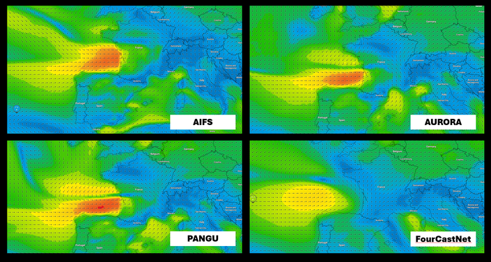
- The differences in the various global models. Is one the best?
- Where can you find models? What about GRIBS?
- What is good practice for the selection, use, display, and interpretation of weather models?
We pull back the curtain to show how weather models work - which will forever change the way you rely on these tools. This class will greatly enhance your understanding and knowledge of these powerful - and ubiquitous tools.

This Class Has a Prerequisite!
Weather Models 201 is an advanced class that builds on the knowledge taught in MWU's Class #7 - Weather Models which is part of both of MWU's acclaimed full-length courses: the Fundamentals Course and the Advanced Course.
To ensure students get the most out of this new class - Weather Models 201 -we are requiring Class #7 as a minimum prerequisite.
If you are already enrolled in MWU's Advanced or Fundamentals Course - you meet the prerequisite and can enroll directly here in Weather Models 201.
For students needing to meet the prerequisite - MWU is providing three different "bundle" options to meet Weather Models 201's prerequisite. They are all great deals offering a discount on the package.
BUNDLE THIS CLASS (LINKS ARE BELOW) WITH:
We always encourage students interested in marine weather to strongly consider enrolling in one of our full-length courses with a very special discount offer. At a minimum you will need to bundle with Class #7.
Please play fair - students that enroll directly in this class without meeting the minimum class prerequisite will be unenrolled and have their tuition refunded.

Weather Models 201: Course Outline
This three part advanced class includes two lectures (each lecture is 1h 20mins), course resources, a quiz and the 50 minute recording of the workgroup session - all online at MWU.
Part One explores the many models currently available as guidance in predicting marine and coastal winds. We look at coverage/domain, resolution, update frequency, and what areas the models are best applied. We explore differences between the models and why some might be better than others. We’ll also remind ourselves that even “bad” models can contain useful information, but you often don't know that a models is "bad" until after the weather has occurred.
In Part Two we explain strategies for proper use and application of weather model “guidance”. At the end of the day, you need to make a prediction. This prediction can support a safe and efficient voyage, or find the winning course in a race. But getting to a prediction can be difficult when faced with an excess of model guidance (too many models - newer model runs).
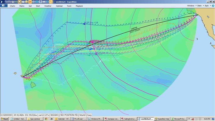
We’ll look at some idiosyncrasies of models and resolution – especially as they apply to "weather routing" in marine navigation software packages like Expedition. There absolutely is a point of diminishing returns when it comes to the breadth of weather model information out there. Meteorologists have come up with some clever ways to deal with the amount of model data out there and minimize the problem of diminishing returns. We will share those techniques and the approach of the pros: weather models aren’t an “answer” – they are a “guide”. Our predictions must be consistent with our understanding of the weather and the underlying science.

Your instructor: Chris Bedford
Like all of Marine Weather University's curriculum - this course is created and taught by legendary meteorologist, Chris Bedford. To say Chris is one of the best marine meteorologists in the world would not be an understatement. He just returned home from his 10th gig as an America's Cup team forecaster. He's worked for Olympic teams, Round the World Race events and campaigns, and is one of the most in-demand forecasters in the world of sailboat racing.
Chris is known for his straight-forward, honest, and practical approach to using weather knowledge as a competitive advantage. He obtained his Meteorology degree at the University of Michigan and is highly regarded in his field, having served as President of the National Council of Industrial Meteorologists and on many professional boards and committees including the American Meteorological Society,
Chris' partner in Marine Weather University - 2x America's Cup winner, Peter Isler helps out in the classroom.
MWU's Weather Guru, Chris Bedford reflects on Weather Models
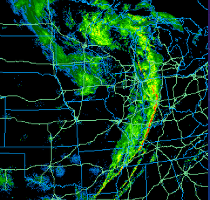
Back in “the day” when I was first studying meteorology at The University of Michigan (between sandwiches from Zingerman’s Deli), it was still early days in the application of weather models. Global models were only just becoming practical, with the Global Spectral Model entering service in 1982. The model had a horizontal resolution roughly 2.5 degrees and just 12 vertical layers, with both the horizontal and vertical resolution decreasing at longer forecasts. For regional forecasts, the Limited Fine Mesh model was available over North America at a resolution of around 125 km - so coarse it didn’t even resolve the Great Lakes!
With steady improvement in computer and communication speeds over the years, model resolution, performance, and availability has improved steadily and dramatically. Today, I can count at least 12 reasonably good Global Models running in operational mode – some under 10 km horizontal resolution and often well over 100 vertical layers. While resolution and run frequency varies among the models, all bring something to the table when it comes to forecast guidance – especially over open ocean. In addition, multiple global models are run in an ensemble manner (reference Marine Weather University Advanced Course), providing hundreds of additional global model runs per day!
At the continental, regional, and local scales, the number of available models is even more staggering, with many models run for specific areas around the world by national meteorological agencies, universities, and private entities. These higher resolution models are extremely useful for providing guidance in forecasting near-coastal winds.

Minimum pre-requisite bundle
Bundle Weather Models 201 with MWU's Course #7 to meet the pre-requisite requirement.
$199 ($49 bundle discount)
Meet this class' pre-requisite requirements with one of these three options
Bundle Weather Models 201 with MWU's flagship course - the 8 class Fundamentals Course to meet the pre-requisite requirement.
$599 ($99 bundle discount)
Ultimate pre-requisite bundle
Bundle Weather Models 201 with MWU's ultimate course - the 16 class Advanced Course!
$879 ($149 bundle discount)
Enrich your weather skills at Marine Weather University!
At Marine Weather University - we strive to provide the very best in marine weather education. Our curriculum is designed and presented by MWU's world-renowned meteorologist, Chris Bedford and is online and available 24/7.
Here's a sampling of our offerings - please browse our course catalogue and take the first step in raising your weather IQ!


